Ever scroll a Hamptons listing and see “South of the Highway” without a clear sense of why it matters? You are not alone. It is a local shortcut that often influences price, insurance, and day-to-day lifestyle. In this guide, you will decode what it means in plain English and see how the trade-offs play out in Sagaponack so you can make a confident choice. Let’s dive in.
What “south of the highway” means
In the Hamptons, “the Highway” refers to Montauk Highway, the main east–west road across the South Fork. “South of the Highway” means a property sits on the ocean-facing side of that road. The phrase is popular because it signals beach proximity, potential ocean views, and a coastal lifestyle that many buyers prioritize. For context on the roadway itself, see the Montauk Highway overview on Wikipedia.
Why it shifts price and demand
Ocean proximity and access
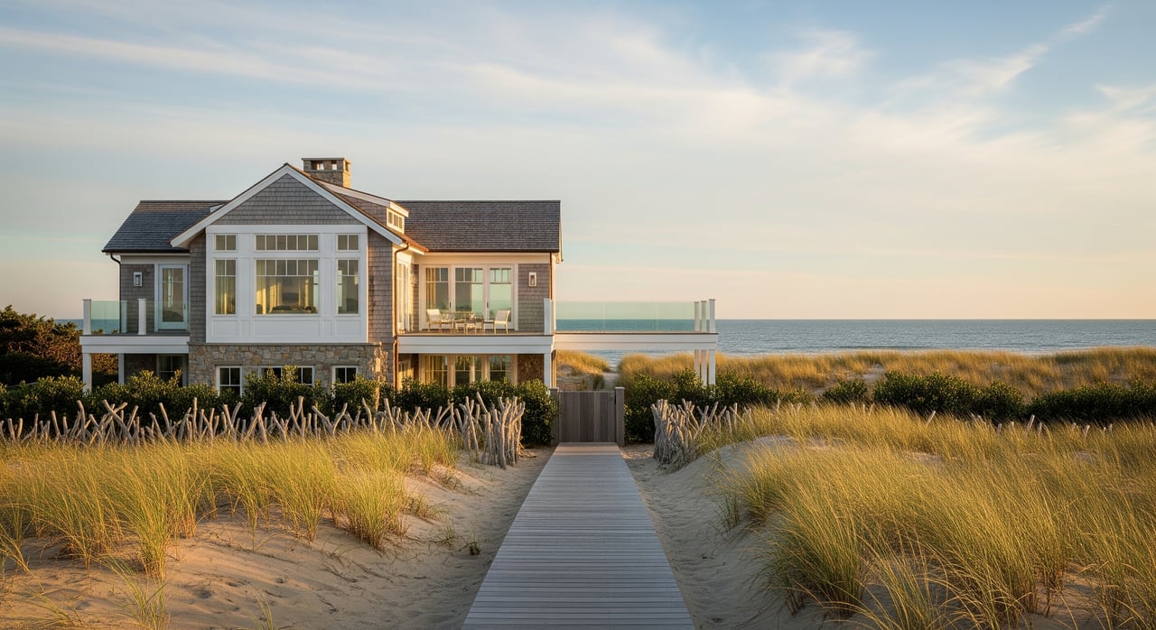
Being closer to the Atlantic often means shorter walks or drives to beaches and the possibility of ocean or dune views. Many buyers value direct dune access or a quick trip to Sagg Main and nearby beaches. That lifestyle convenience can translate into a premium.
Scarcity and lot traits
Parcels between Montauk Highway and the shoreline are limited. Many are larger estate lots with unique siting or view corridors. Scarcity tends to support higher prices when quality and location align.
Lifestyle signals
“South of the Highway” is a well-known signal for the classic Hamptons beach experience. Buyers seeking ocean breezes, morning walks to the dunes, and a coastal routine often focus their search here. That demand has historically reinforced the premium.
Regulations, risk, insurance
Coastal parcels face more rules and potential costs. Floodplain and coastal zones may require elevated construction, stricter setbacks, or specialized foundations. You can verify a property’s flood zone through the FEMA Map Service Center. Local land-use rules, including coastal considerations, are available through the Town of Southampton and the Village of Sagaponack.
Resale and liquidity
Hamptons buyers have long prioritized ocean proximity. Properties south of the Highway often benefit from broader resale demand. At the same time, top-tier north-of-Highway estates can command significant prices for privacy and pastoral views, so value is always site-specific.
Sagaponack: the on-the-ground trade-offs
Sagaponack sits within the Town of Southampton and has a low-density, estate-scale character. Montauk Highway runs through the village. South of the road are dunes and the Atlantic; north of it are open farmland, rolling fields, and large private parcels. The result is a real choice between different but equally prized settings.
South side advantages and costs
- Advantages: immediate beach lifestyle, potential ocean or dune views, strong prestige and clear resale signal for ocean-focused buyers.
- Costs: higher exposure to storm surge, erosion, and coastal flooding; likely need for elevated foundations and coastal permitting; potentially higher flood and wind insurance premiums.
North side advantages and costs
- Advantages: expansive farmland vistas and privacy, often equal or larger parcels, typically lower direct coastal insurance exposure, and a quieter setting away from public beach access points. For preserved farmland and open-space context across the East End, see the Peconic Land Trust.
- Costs: longer walk or drive to the ocean; for some buyers, the lack of immediate beach access can affect perceived value and future resale strategy.
Access and circulation
Montauk Highway is the main artery, and local beach roads funnel seasonal traffic. South-of-Highway locations close to public access may see increased summer activity. Many estate areas remain private and quiet due to long driveways and setbacks, so traffic impact varies by block.
Parcels and building envelope
Sagaponack features large estate lots on both sides of the Highway. South-of-Highway parcels may have tighter buildable envelopes due to dune protections, wetland buffers, or elevation rules. Confirm current requirements with the Village of Sagaponack and the Town of Southampton before you plan additions or new construction.
A simple buyer framework
Use this checklist to compare options in Sagaponack.
- Clarify your priorities
- Rank what matters most: immediate beach access and views, privacy and acreage, insurance profile, proximity to nearby hamlets, or year-round utility.
- Measure objective location attributes
- Time the drive or walk to the nearest beach access and to Sagg Main.
- Check elevation and flood zone using the FEMA Map Service Center.
- Review zoning, setbacks, and buffers with the Town of Southampton and the Village of Sagaponack.
- Estimate recurring and compliance costs
- Get a preliminary quote for flood and wind insurance based on the specific parcel and structure.
- If you plan to renovate or expand, review septic requirements. Suffolk County’s onsite wastewater program is outlined by the Department of Health Services.
- Consider coastal maintenance costs such as dune stabilization and storm-related repair.
- Analyze resale and liquidity
- Ask for recent comparable sales both south and north of the Highway to understand historical spreads.
- Decide which buyer pool is most likely for your future resale: ocean-focused or estate-and-farmland focused.
- Complete site-specific due diligence
- Obtain any elevation certificates, surveys, and information on wetlands or dune setbacks.
- Review septic capacity and potential upgrade paths.
- Ask about historical storm impacts and any prior insurance claims.
- Confirm any rights or permits for beach or dune access if the parcel abuts those areas.
- Weigh neighborhood and seasonal factors
- Consider summer traffic patterns near public access points.
- Visit at different times of day and week to better understand noise and privacy.
Risks and compliance to plan for
- Flooding, surge, and erosion: South-of-Highway properties are more exposed. Verify flood zones and base flood elevations through the FEMA Map Service Center.
- FEMA coastal zones: V and coastal A zones can drive foundation design, elevation, and insurance pricing.
- Insurance and lender conditions: Expect potential requirements for elevation certificates and stronger underwriting for wind and flood coverage.
- Septic and wastewater: Renovations may trigger upgrades under Suffolk County nitrogen-reduction rules. See current guidance from Suffolk County Department of Health Services.
- Coastal permits: Dune disturbance, erosion control measures, and shoreline work often require village or town approvals. Consult the Village of Sagaponack and Town of Southampton before planning work.
Pricing and resale takeaways
- South-of-Highway remains a recognized premium because it concentrates the coastal lifestyle many buyers want and offers scarcity near the ocean. The result is often stronger resale appeal within the ocean-focused buyer pool.
- North-of-Highway can rival or exceed pricing for standout properties offering acreage, privacy, and farmland vistas, particularly on premier lanes and in preserved view corridors. The buyer pool here values seclusion and a pastoral setting.
- In Sagaponack, the better choice depends on your specific goals. If you prioritize immediate beach access, South-of-Highway may be the efficient option. If you prize privacy, acreage, and lower coastal exposure, North-of-Highway may be the better fit. Either path can be a strong long-term hold when the site, siting, and approvals align.
Next steps
If you are early in your search, use the framework above to narrow your must-haves and measure objective factors like flood zone, setbacks, and septic requirements. From there, a focused tour of both sides of the Highway will quickly reveal which setting fits your lifestyle and long-term plans. For confidential guidance, pricing context, and a streamlined path from short list to close, connect with Dennis Saglam. Schedule a confidential consultation and get a clear plan tailored to Sagaponack’s on-the-ground realities.
FAQs
What does “South of the Highway” mean in the Hamptons?
- It describes properties on the ocean-facing side of Montauk Highway, a local shortcut that signals beach proximity, potential views, and coastal-lifestyle convenience.
Is paying a premium for south of the Highway in Sagaponack always worth it?
- It depends on your goals. Ocean-focused buyers often value the proximity and resale signal, while privacy-focused buyers may prefer north-of-Highway estates with farmland vistas.
How do FEMA flood zones affect Sagaponack homes south of the Highway?
- Coastal parcels may fall in V or coastal A zones, which can require elevated construction and increase insurance costs. Verify zones at the FEMA Map Service Center.
What should I know about septic and renovations in Sagaponack?
- Renovations can trigger septic upgrades under county rules. Review requirements with the Suffolk County Department of Health Services before planning.
How can I verify building setbacks and coastal buffers for a Sagaponack property?
- Check local zoning and coastal regulations with the Village of Sagaponack and the Town of Southampton, and confirm conditions on a current survey.
Does north of the Highway mean lower insurance in Sagaponack?
- Not always, but north-of-Highway parcels typically have less direct coastal exposure. Insurance still depends on the exact site, structure, elevation, and carrier underwriting.